Showing posts with label OTT. Show all posts

Friday, 10 July 2026

Director for water interest group.

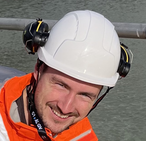
SWIG (Sensors for Water Interest Group) has announced the appointment of Angus Fosten as Director. Angus is Sales Lead for the Ott, Partech and In-Situ brands in Britain and has over 35 years of experience in water measurement instrumentation.

Angus Fosten -
'Measurement technology geek.' 

“We are delighted to welcome Angus to the SWIG board,”
says SWIG Chair Dr Mike Strahand. “He brings a wealth of knowledge and expertise, and is well known in the water sector, its supply chain and in academia. More importantly, he is passionate about bringing the benefits of measurements to processes and to environmental protection, so SWIG will be the ideal place for him to help exchange knowledge on water monitoring.”

Describing himself as a ‘measurement technology geek’ Angus is fascinated by the latest developments in sensors that improve accuracy, stability, sensitivity, repeatability, ease of use and connectivity, while lowering costs, reducing maintenance requirements and extending calibration intervals. However, he says: “Everybody knows that you can’t manage what you don’t measure, but that does not mean measurement for measurement’s sake. It is vitally important that we monitor parameters that provide useful insights for actions, and that is why SWIG plays such an important role; bringing together stakeholders from all corners of the water sector.”

Mike Strahand agrees: “Sensors play an essential role in process control, checking compliance with performance targets and regulations, and providing insights for process optimisation and environmental protection.”

The cost of measurement instrumentation is generally negligible in comparison with most project costs. However, as Angus explains: “AMP8 includes over £104 billion of planned expenditure on water industry assets, and AMP9 is likely to be even higher. Sensors will therefore perform a critical role in maximising the value of this investment, and I hope that the water industry and other stakeholders will engage proactively with SWIG to share their knowledge, experience and best-practice.”


#SWIG #OTT #Water @_Enviro_News 

Wednesday, 14 August 2024

Innovation in water monitoring shortlisted.

OTT HydroMet’s XLink datalogger has been shortlisted for the WWEM 2024 ‘Most Innovative Water Monitoring Solution’ award.

XLink is a unique Wi-Fi enabled datalogger with two-way communications capability via IRIDIUM® or Cellular technology. Designed specifically for environmental monitoring, XLink is sensor agnostic, accepting SDI12, RS485 and 4-20mA inputs, and capable of transmitting up to 32 independent measurements. This means that the XLink can log and transmit remote monitoring data for parameters such as water level and flow, water quality, air quality, and meteorological parameters such as wind, precipitation and solar radiation.

“We are delighted that the XLink has been shortlisted for this award,” explained OTT HydroMet’s Dr Liam Goodes. “XLink is much more than just a highly sophisticated datalogger. With built in communications options it is able to exploit low-cost cellular comms, and where cellular is not available, IRIDIUM® satellite is a simple, elegant solution at a cost that many of our customers now find surprisingly low.”


* WWEM Conference & Exhibition is scheduledat for Birmingham (GB) from 9 –10 October 2024 and those with an interest in remote environmental monitoring can vote for various categories here. 

@OTTHydromet @_Enviro_News #WWEM #Water #Environment

Tuesday, 28 November 2023

Environmental compliance in closed mines.

For the last nine years, Severn Trent Services, has managed a contract for mine water treatment across the Coal Authority estate, including 73 mine water treatment schemes in England, Scotland and Wales. These schemes take the form of three types: passive, pumped-passive and active. Water levels are one of the elements monitored closely at these sites, which have approximately 600 monitoring points. The majority of the readings are obtained manually with dip tapes, and by using loggers, around 125 of which are OTT ecoLog water level loggers.

Force Cragg Mine (1836-1991), Lake District, England.
At most sites, mine water is pumped to a treatment facility which employs oxygenation, filtration and sedimentation to raise the quality of the water in compliance with discharge consents.

“Mine water from legacy coal mines is treated at many of these sites utilising settlement lagoons and reed beds,” explains Oren Environmental’s Data & Reporting Manager Paul Robinson. “The effective management of these resources is heavily dependent on reliable data including water level measurements, and we have been using OTT instruments to support this since 2016. With the benefit of water level data, we can ensure that the flow of water through the lagoons and reedbeds maximises effective treatment before water is discharged to watercourse.

“One of the additional capabilities of the loggers is to create alarms and this is something we are investigating for future use,” Paul explains.

“In addition to the older ecoLog 500’s and the newer ecoLog 1000’s, we also utilise five ecoLog 800’s to collect and monitor conductivity measurements. Conductivity data can be used to assess the quality of water by identifying minerals etc. that are present in the water.”

Where the ecoLogs are deployed in surface water weirs, the level measurements are translated into flow, which further informs the management of the treatment process.

Many of the original water level loggers were ecoLog 500 devices, some of which are still in operation. However, these are being gradually replaced by ecoLog 1000 instruments. “The ecoLog 1000 has an extremely advantageous feature,” Paul explains. “Data from the older units was collected using a USB cable, however the newer instruments have Bluetooth connectivity, which means that our operators can connect more quickly and in adverse weather. Where possible, they can also drive close to the logger and communicate wirelessly with a smartphone or laptop from their vehicle.”

The ecoLog 1000 is an all-in-one instrument, including a water level sensor, a logger, and a built-in modem. It requires no additional tools for maintenance or battery replacement, and has been designed for long-term, unattended monitoring in challenging conditions. Key features therefore include extremely low-power operation including Bluetooth Low Energy, as well as a rugged stainless steel pressure probe housing and a ceramic temperature compensated sensor. Typically, remote connectivity is achieved via cellular network LTE-M (Cat-M1).

Force Crag Mine in the Lake District (North East England) is a good example of an extremely remote former mine with challenging environmental conditions. Cellular coverage is very limited on-site, so OTT built a local network which transmits water level data via radio to two loggers located in a higher position. Data from these loggers are then transmitted regularly to Oren’s FTP Server.

Mining commenced at Force Crag in 1835, and it became the last working metal mine (zinc, lead and barytes) in the Lake District, prior to its final closure in 1991. Metal pollution (zinc, cadmium and lead) from the mine polluted the Coledale Beck, a tributary of the River Derwent and Bassenthwaite Lake Special Area of Conservation.

The Coal Authority, working in partnership with the Environment Agency, Newcastle University and the National Trust, devised an innovative passive mine water treatment scheme to reduce the levels of metal pollution entering the river. The scheme, which officially opened in 2015, diverts water from the Level 1 adit (horizontal passage to an underground mine) and routes it through a buried transfer pipe to two vertical flow ponds for treatment.

The ponds were built using the existing bunding of the former mining tailings lagoon, lined with a geomembrane, and filled with a compost treatment mix. Water is fed into the ponds, where it flows down through the compost and passes into a wetland, planted with soft rushes. The wetland filters any remaining solids and oxygenates the water prior to discharge into the Coledale Beck.

“Each site presents its own challenges,” Paul Robinson explains. “Many are in remote areas and in different environments, so we do our best to ensure we maximise the equipment to hand such as the OTT ecoLogs.” Looking forward, he says: “Remote telemetry is particularly advantageous, because it provides access to more frequent data than manual dips due to the schedule of visits that we work to.”


@OTTHydromet @stwater @_Enviro_News #Environment #Automation #Water

Friday, 2 June 2023

150 years in hydrology and meteorological measurement.

For 150 years, OTT HydroMet’s product brand, ‘OTT’ has been at the forefront of innovation, pioneering state-of-the-art hydrological and meteorological instrumentation. Originating in Germany, OTT has since expanded to be a global industry leader providing the highest quality products, customized solutions, and technical support.

OTT HydroMet plans to celebrate the 150th Anniversary of the OTT product brand with a five-month event highlighting new innovations, special customer events, global success stories, and more.

• New Innovations: The OTT brand continues to innovate with its latest release of the OTT PLS 500, smart pressure level sensor and the OTT ecoLog 1000, an all-in-one level logger and telemetry solution now with conductivity measurements.
• Special Events: A series of both private and public customer-facing events are scheduled across the globe including a dedicated customer event, Anwenderforum, at the Kempten headquarters in September.
• OTT Product Brand Archives: In this digital social campaign, followers will be guided through the history of the OTT brand, recounting inspiring moments and stories that contributed to the advancement of environmental monitoring.

“This significant milestone for OTT HydroMet occurs at a time when our mission of enabling decisions that protect lives and the environment is more important than ever,” stated Tom Bolling, President, OTT HydroMet.
“With our commitment to this mission and to our customers, OTT HydroMet will continue inspiring, enabling and sharing our expertise with generations of scientists, engineers, and hydrologists around the world.”

The OTT HydroMet Anniversary celebrations kicked off this May and continues through October 2023.

@OTTHydromet @_Enviro_News #OTT150, #OTTImpact #Environment

Tuesday, 28 February 2023

Environmental monitoring experts appointment.

OTT HydroMet has announced the appointment of Dr Liam Goodes as Sales and Business Development Manager in the south of Britain.

Dr Liam Goodes
Liam has an MSci in Oceanography from the University of Southampton and the University of Bordeaux, and a PhD in Marine Surface Engineering from the University of Southampton. He has since worked in optics and scientific hardware sales for a number of years, and in his spare time, he is a keen competitive archer.

Looking forward, Liam says: “Working closely with customers, the OTT HydroMet Group is constantly developing new technologies, and now offers a comprehensive package of solutions for environmental monitoring, communications and data management. I am therefore extremely excited to be appointed to this role, and look forward to helping customers gather the measurement insights they need.”

@OTTHydromet @_Enviro_News #Environment #PAuto

Wednesday, 22 February 2023

Communicating logger.

Additional communication options have been added to the OTT HydroMet water level and temperature logger - the OTT ecoLog 1000. Now equipped with low-power LTE-M (CAT M1) connectivity, the device provides water professionals with simple, fast access to their water level data.

LTE-M is a type of low-power wide area network communication technology standard for a wide range of cellular devices and services in machine (M2M) and IoT applications, such as networks of groundwater monitoring sites. LTE-M has 5G compatibility making it future proof as cellular networks evolve. Mobile devices, smart phones, and tablets operating with Android, iOS or Windows 10 are all supported. In addition, simple local communication is available via Bluetooth.

By supporting 4G and cellular IoT transmission, LTE-M increases the speed and lowers the cost of data transmission, enabling users to conduct remote two-way operations such as configuration, network management, data download or the viewing of real-time data.

Robust, simple to install, and running on low-power with a 10-year battery life, the ecoLog 1000 has been designed specifically for long-term, unattended deployment. Enhanced connectivity further reduces the requirement for site visits, and lowers the cost of ownership.

@OTTHydromet @_Enviro_News #Water #Waste

Wednesday, 30 November 2022

Water level sensor is smart.

A new water level sensor, the OTT PLS 500, which combines robust reliability and accuracy with the advantages of smart sensor technology has been introduced. Building on decades of experience, the redesigned PLS 500 retains key elements of the trusted, robust, and reliable OTT PLS, while enhancing the sensor to be intuitive and user friendly.

The OTT PLS 500 is a vented water level and temperature sensor with a stainless-steel body and a robust ceramic pressure cell for improved accuracy and reliability. As a smart sensor it includes built-in QA/QC and metadata to verify sensor performance and validate data. This means that the sensor is ideal for extended deployment in remote locations. 

“This new technology is all about long-term accuracy and reliability,” explains Greg Koch, Global Product Manager, OTT HydroMet. “The PLS 500 is fitted with a humidity sensor and an inclinometer to provide insight to mitigate condensation in the vented line and sensor movement or misalignment. The result is a smart sensor that continually checks itself to ensure that measurements are being taken correctly, with the ability to raise alarms if necessary.”

In addition to pressure (water level), the device also measures temperature to facilitate the automatic compensation of level measurements based on variation in water density. An important feature of the PLS 500 will be a new capability to conduct data processing to improve the efficiency of data reporting and eliminate manual data post-processing/ analysis. For example, the probe will be able to automatically undertake internal calculations such as averages, minima and maxima, as well as discharge calculations from either a user-defined rating table or an ISO 1100-2 exponential formula set-up via SDI-12 commands.

Communication with the PLS 500 has also been enhanced, with the standard/simple communication protocols of SDI-12 or Modbus RTU (via RS-485). Neatly summarising the main advantages of the PLS 500, a Device Beta Tester with the State of Colorado Natural Resource Agency said: “The metadata and sensor flags are a game changer to ensure quality data remotely.”

@OTTHydromet @_Enviro_News #Water #Waste 

Field service for water strengthened.

OTT HydroMet has recruited a further field service engineer to its team in Britain. Simon Cockcroft joins from Siemens and will be responsible for helping with field installations, instrument service and calibration. 

Simon Cockcroft
“I have always wanted to work with the latest technologies, but in the field, and OTT’s installations are often exactly that,”
Simon explains.

OTT HydroMet’s European Service Manager, Robin Guy says: “We are delighted to welcome Simon to the team. Our company’s longstanding reputation is built on the quality and reliability of the environmental data that our equipment delivers, so we need people of Simon’s calibre to ensure that we continue to deliver the highest possible levels of service.”

Simon has a first-class degree in Electronic Engineering from Newcastle University, in addition to an MSc in Mechatronics and Robotics from the University of Leeds. At OTT HydroMet, he will be responsible for installing and servicing the company’s range of environmental monitoring, communications and data management products.

@OTTHydromet @_Enviro_News #Water #Waste #Maintenance

Thursday, 18 August 2022

Sustaining a fen and capturing carbon dioxide.

In 2001, five organisations came together to set out a vision for the Great Fen, with the aim of providing a more sustainable future for the area. In many respects, this work focuses on restoration by managing water levels, so a network of monitoring wells has been established. In this article, Wendy Strain from OTT HydroMet explains how this monitoring program is helping to achieve the ambitious goals that have been set for the Great Fen.

Background.
The Great Fen is an expanse of nationally significant fen landscape between Peterborough and Huntingdon in the East of England. The area contains many farms and villages as well as two National Nature Reserves; Woodwalton Fen and Holme Fen. Holme Fen and Woodwalton Fen are both part of the Great Fen, a habitat restoration project, involving the local Wildlife Trust, Natural England, the Environment Agency, Huntingdonshire District Council and the Middle Level Commissioners.

The Great Fen covers 14 square miles of land that is being restored to wild fen over a 50-100 year timescale, creating a huge nature recovery network, providing a Living Landscape for fenland species including threatened fen wildlife, such as bitterns and otters. A mosaic of different wetland habitats has been established to support a wide variety of wildlife, such as dragonflies, butterflies and amphibians. This habitat is also suitable for flowers and other plants, some of which are found almost nowhere else in Britain such as the Fen violet and the Fen woodrush.

In 1630 a group of wealthy landowners, headed by the Earl of Bedford, set out to drain the fens for agriculture and to minimise winter flooding. Many of the local people were fiercely opposed to the draining, believing it would deprive them of their traditional means of livelihood from wildfowling, fishing and reed cutting, and a group known as the ‘Fen Tigers’ vandalised the dykes, ditches, sluices and reedbeds. Nevertheless, by the end of the 17th Century the drainage project was complete.

This drainage caused more problems, such as peat shrinkage, and more drainage projects followed. In the 1800s, conscious of the likely shrinking effect of draining the peaty soil around Whittlesea Mere, William Wells, another wealthy landowner, instigated the burial of a measurement post at Holme Fen, which was anchored in the bedrock and cut off at the soil surface. Today, around 4 metres of the post is showing above ground, recording the ground subsidence since 1852. The ground level at Holme Post is now 2.75 metres below sea level – one of the lowest land points in Great Britain.

Several issues have arisen as a result of the drainage. Firstly, there has been a huge impact in local ecology and biodiversity with the loss of a large area of wetland. Also, as the ground level subsided it became less sustainable to pump water up into the main drain. The loss of peat has become a major concern, because, as a carbon sink, peat is hugely important in the fight against global warming.

Peat forms in waterlogged, acidic conditions when layers of partially decomposed mosses and other bog plants accumulate. The process is very slow; it can take up to 1,000 years to form just one meter of peat. Nevertheless, around 60% of the world’s wetlands are made of peat. The plants which form peat capture carbon dioxide from the atmosphere and as a result, large quantities of carbon are trapped in the peat. However, if the peat is drained, it decomposes much faster; releasing the stored carbon. Peat burning has the same effect, but much faster.

It has been estimated that the reduction of peat loss in the Great Fen, coupled with the capturing of carbon by vegetation is saving 325,000 tonnes of CO2 from being released each year.

The project is also a good example of natural flood management (NFM) because it provides extra water storage after heavy rainfall, which slows water flow and helps to protect surrounding towns, villages and farmland from the risk of flooding.

Water level management.
The drainage of the fens incurred widespread ecological harm, but the solution is significantly more complicated than simply raising water levels to create wetlands. Henry Stanier explains: “There are a number of factors that impact the restoration process. Firstly, the geology of the area is like a layer cake, and each layer has different hydrological properties. Secondly, the Great Fen includes a number of commercial farms, so it is important to understand and manage their groundwater status. Thirdly, the surface water requirement varies according to the time of year, due to the needs of a wide variety of flora and fauna, including breeding birds. Fourthly, along with various partners, we are conducting numerous research programs, most of which are affected by water level. For example, we have trial plots with raised water levels, in which we are investigating the performance of different plant species. These include Sphagnum or ‘bog moss’ which stores water, prevents the decay of dead plant material and eventually forms peat, and we are also trialling the wetland cropping potential of Glyceria fluitans, a robust perennial aquatic sweet grass.”

Water level monitoring.
Working with a team of over 60 volunteers Henry delivers a monitoring program for the project area, which is currently around 3,700 Hectares. 40 wells have been installed in strategic locations, each to a depth of around five metres. 37 of these have OTT Orpheus Mini water level loggers, which record groundwater level every hour, every day of the year. Henry collects the data from these loggers once or twice per year, or more frequently where the data is of greater significance.

Three of the wells have been fitted with OTT ecoLog water level loggers. These devices have the ability to transmit both stored and live data to a secure website which Henry can access with any internet-enabled device at any time, and from anywhere. “This is a tremendous advantage,” he explains. “With such a large area to cover, field visits can be time-consuming and therefore costly, so we install the OTT ecoLogs in the wells of greatest interest, so that we can, for example, view the effects on groundwater levels when we transfer surface water into an area.”

Henry’s team operates a number of trial plots by the dipwells; investigating how the vegetation is changing. His team also correlates groundwater levels with vegetation growth, in order to better understand optimal growing conditions.

The Great Fen area includes a number of commercial farms, which operate both drainage and irrigation processes, so the groundwater monitoring program also helps to understand the effects of these activities. In addition, new farms are regularly acquired and incorporated into the Great Fen, so the monitoring work helps to manage the restoration of this land from agriculture to fenland.

Summary.
Henry says: “Fenland restoration depends heavily on a deep understanding of the geology and the water table, and the effects of water status on the local ecology. The water level monitoring that we undertake provides the data that underpins the science that informs the important management decisions that are made. The quality and reliability of the OTT water level loggers is therefore vital, and we look forward to expanding our network of monitors as the project continues to grow.”

@OTTHydromet @WildlifeTrusts @_Enviro_News #Environment #Britain

Friday, 17 June 2022

Service technician.

Developer and manufacturer of technologies seeks technician to help detect floods, make solar power more efficient, protect the environment, and ultimately save lives.

Following growth in the OTT HydroMet business in Britain, they are seeking a new service technician to add to their team there.

OTT HydroMet’s Service Technicians are the custodians of the company’s long-standing customer relationships. The successful applicant will be responsible for supporting the Senior Field Service Technicians, both in the field and the workshop. This role has direct customer contact as well as high visibility and exposure to all departments in the organisation. The medium to long-term goal for this role will be to reach a comfort level to work independently in the field.

This position will be based at OTT’s Sheffield (GB) facility, with 70% - 80% travel to customer sites. Most travel will be local day trips, but some may require an overnight stay.

Applicants must have completed studies or technician training, preferably in the field of electrical engineering, information and communication technology, or hydrometry/ meteorology.

A competitive salary is available, along with the benefits of working for Danaher - a global organisation with over 80,000 employees.

@OTTHydromet @_Enviro_News #Environment #Safety  #Britain

Thursday, 24 February 2022

Level measurement to help lessen bridge scour.

Engineers at Transport Scotland have investigated the potential for water level monitoring systems to help mitigate risks where transport infrastructure interacts with moving water. The trial was conducted at a bridge over Vales Burn near Hawick in Scotland, and the monitoring equipment was provided by OTT HydroMet. OTT’s Wendy Strain says: “The system was set to deliver alarms at pre-set water levels, which enhanced the timing and efficiency of site inspections.”

Climate change is increasing the frequency and severity of extreme weather events such as storms and floods. This presents a growing threat to structures that could be susceptible to scour during periods of high water flow. The trial was therefore established to determine whether access to remote water level measurements could enhance the protection of critical transport infrastructure.

Background
The stability and integrity of structures such as bridges, culverts and walls can be compromised by ‘bridge scour’ which is caused by fast-flowing water that removes material from around the footings of bridge abutments or piers.

There are three main types of scour. Local scour is caused by the faster water flow that occurs around piers and abutments. Constriction scour is created by water accelerating through a narrow opening, and degradation scour can lower a river bed over a longer period, both upstream and downstream of a structure.

The effects of bridge scour can be disastrous. For example, during a flood in 1987, the Glanrhyd Bridge in Carmarthenshire (Wales) partially collapsed, causing a train to plunge into the River Towy, killing the driver and three of the passengers. In 2009, failure of the Malahide Viaduct in Dublin, (IRL) was caused by foundation scour. Two commuter trains packed with hundreds of passengers were just seconds away from disaster when a 20-metre section of the viaduct collapsed after they passed over it. Nobody was killed, but travel chaos ensued.

Today, highways and rail authorities conduct regular inspections in order to asses scour risk.

Bridge scour in Scotland
Transport Scotland is split into four operational regions, and Jim Brown is South East Unit Bridge Manager. Prior to this position, Jim spent 42 years as a civil engineer with Network Rail, 13 years of which he headed the geotechnical discipline in Scotland – so it is fair to say that Jim knows a thing or two about bridge scour. “The most important objective is the early detection of increased risk,” Jim explains. “Once we have established which structures are more vulnerable during flooding, we are able to implement different levels of mitigation.

“Much research has been undertaken in an attempt to be able to monitor scour, but this is obviously problematic because potential scour takes place at times when it is not possible to see the river bed and certainly not possible to deploy divers,” Jim adds. “For this reason, the continuous monitoring of water level is not the perfect solution, but may be the best and most practicable.”

Water level is already used as a risk factor by the inspection teams where the 1 in 200 flood level is shown on structures by a fixed marker. However, Transport Scotland have to monitor 700 structures which are over or adjacent to water, and site inspections are costly; both financially and in resources. The inspection system could therefore be more efficient if it could be informed by remotely available water level data, especially if the data enables faster, more efficient implementation of mitigation measures.

If a structure is determined to be high risk, a hydrological assessment is undertaken. This may prompt a requirement for strengthening of the structure itself, as well as measures to protect or fill potential scour zones, and/or to alter water flow and disrupt vortices. In extreme cases, when a potentially vulnerable structure is exposed to high water, it may be necessary to close highways or rail lines until the level of risk can be lowered.

Vales Burn trial

In light of the potential for live water level data to inform the bridge inspection process, OTT HydroMet was invited to propose a monitoring system that could be evaluated at a culvert on the Vales Burn. “Our solution was comprised of an OTT ecoLog 1000 water level logger in a stilling well, with cellular data connection to Hydromet Cloud; a web-enabled platform for processing, displaying and storing hydrometeorological data,” explains Wendy Strain. “Data were set to be transmitted routinely every 6 hours, but two alarm levels were set to prompt SMS alerts, when necessary.”

The monitoring system was installed in September 2021, and Jim Brown says: “The trial is a great success; we utilise the Scottish Environmental Protection Agency (SEPA) flood alert warnings to monitor flooding and it has been our experience that the highest water levels generally occur about one or two days after a storm, so one of the main objectives of the trial was to determine the best time to despatch inspection staff.

“The monitors did issue alerts during the trial, but these were when levels met the lower alarm level, and in these cases, further interventions were not required. With the benefit of water level data, we will therefore be able to optimise the deployment of the inspection teams and mitigate risk,” Jim adds.

Summary
Bridge scour is a long-standing problem for transport infrastructure, so the deployment of remote water level monitors/alarms that can be accessed via PCs or a mobile App offers rail and highway authorities an opportunity to optimise their scour assessment activities, prioritise countermeasures, improve transport resilience and protect safety.

Reflecting on the trial Jim says: “This project has shown that a network of water level monitors could inform bridge engineers of potentially affected structures. I understand that the Hydromet Cloud platform is able to connect with an almost infinite number of water level monitors, so we may be able to roll this out on a larger scale in the future.”

@OTTHydromet @_Enviro_News #Environment #Safety

Wednesday, 24 November 2021

Appointments to fight climate change and develop mitigation strategies for severe weather.

As the world is seeking new ways to fight climate change and develop mitigation strategies for severe weather, OTT HydroMet’s British business has invested in two new positions to help meet that need.

Lewis Taylor
“Our technologies and data management solutions enable customers to monitor water resources and weather more effectively than ever before,” explains OTT HydroMet’s Robin Guy. “This means that we can play a role in not just monitoring the changing climate, but also helping to create severe weather warning systems that issue timely alerts to protect life and property. We have therefore recruited two new highly qualified and experienced business development managers that will offer customers the highest levels of support as they plan their monitoring and rapid response capability.”

Lewis Taylor will support old and new customers in the south, and Wendy Strain will cover the north.

Wendy Strain
Lewis has a first class degree in Mechanical & Manufacturing Engineering from the University of South Wales, and a Post Graduate Certificate in Professional Engineering from Cardiff University. He has worked as a CAPEX and OPEX process improvement engineer on several major water projects, and has 15 years of experience in sales and project management for major industrial water customers.

Wendy has a degree in Applied Chemistry from Liverpool John Moores University, and has 15 years of experience in municipal and industrial water and wastewater treatment, including 8 years in a consulting role; providing technical advice and training on mechanical and chemical water treatment.

“We are delighted to welcome these two talented individuals to our UK team,” adds Robin Guy. “The UK is already experiencing more frequent instances of severe weather, and COP26 has highlighted the fact that this situation is likely to worsen in the coming years. “We are therefore determined to help customers ensure that their monitoring networks are better able to detect issues such as intense rainfall, rising water, flooding and severe winds. These issues threaten lives and infrastructure such as highways, railways, buildings, industry and domestic housing, so Lewis and Wendy will be tasked with helping customers take advantage of the latest technologies in remote measurements, communications and data management software.”

@OTTHydromet @_Enviro_News #Environment #Britain

Monday, 23 August 2021

Virtual booth serving environment protection.

OTT HydroMet is to host a virtual exhibition booth at this year’s WWEM 2021 event; providing visitors with access to a world of expertise in sensors, dataloggers, telemetry and data management software for monitoring water and meteorology.

Taking place on 13th and 14th October 2121, and with a clear focus on Water, Wastewater & Environmental Monitoring, WWEM 2021 will provide pre-registered visitors with free access to a range of conferences and workshops, as well as the opportunity to arrange appointments with experts from OTT HydroMet’s global locations.

“As a virtual event, WWEM will enable us to provide technical support from almost any location in the world,” explains OTT’s Application Development Manager for Europe Katja Weber. “However, given the variation in time zones, we are encouraging visitors to pre-arrange appointments with us; either via the exhibition portal or directly via our website.

“At traditional exhibitions, most of the visitors are looking for help and advice such as: where to install monitors; which sensors to deploy; what service/calibration routine to choose; which loggers can handle remote operation; what telemetry method would be most cost-effective; how the system should be powered, and which data management platform to employ,” explains Katja.

“Experts from OTT HydroMet will be available to discuss all of these issues, as well as to demonstrate the latest technologies. There will also be a live feed to real-world water level data from one of our customer sites.”

@OTTHydromet @_Enviro_News #Water #Environment

Friday, 9 July 2021

Water management - fantastic opportunity.

In this article Nigel Grimsley from OTT HydroMet explains why Big Data in the water sector represents a fantastic opportunity.


Water security can be defined as the availability of a sufficient quantity and quality of water to sustain livelihoods, health, socio-economic development and ecosystems. To achieve this goal, water managers need timely access to reliable, insightful, defensible data, but with the volume and speed of data now available, will existing data infrastructure be able to cope?

Recent developments in sensors, dataloggers and telemetry, have delivered intelligent monitoring systems that are able to operate remotely, running on very low levels of power and delivering reliable data in real-time. This has prompted dramatic growth in the implementation of high-intensity monitoring systems that generate enormous volumes of data. These systems also possess advanced alarm capability; issuing alert messages by SMS, email etc. when pre-set conditions arise.

Water management policies must be sustainable and resilient, so it is vital that both strategic and operational decisions are based on sound data. However, if data are not managed correctly, users may become ‘data-rich but information-poor’, so some of the most important decisions in the organisation of a monitoring programme relate to the ways in which data will be managed.

Working at every stage of the data collection process, OTT HydroMet has developed sensors that can operate remotely for extended periods; loggers that run on very low power but provide enormous data processing capability; telemetry solutions to transmit data from and to anywhere, and software that can assimilate vast quantities of data. The latest software (as a service) packages, such as Hydromet Cloud and AQUARIUS, are able to provide insights and alerts, while also providing easy access to live or historical data.

In combination, the OTT HydroMet solutions, from sensor to screen, enable water managers to meet the needs of disparate stakeholders and enhance water security. 

When it comes to the management of water, Big Data represents a fantastic opportunity.

@OTTHydromet @_Enviro_News #Utility #Automation 

Friday, 5 March 2021

Above the flow!

The OTT SVR 100 non-contact surface water velocity radar sensor has been designed to overcome the challenges presented by monitoring water resources that can quickly change from languid flow to a raging torrent.

“If you need to monitor the velocity of a river, it is often better to do so from above, so that your sensor is not affected by high water or debris,” explains OTT MD Nigel Grimsley. “The OTT SVR 100 was therefore designed to be mounted at a fixed point on a bridge for example, away from potential flooding. However, uncertainties can also arise from vibration caused by wind or traffic, so the SVR also has integrated vibration and tilt sensors to ensure that these effects do not harm the quality of the monitoring data.”

The sensor is compact, simple to install, and with a power-down feature operates from a long lasting battery, that can be charged by a solar panel.

Velocity measurements and sensor status information from the vibration and tilt sensors are available via SDI-12, RS-232, RS-485, and Modbus protocol.

Summarising, Nigel says: “We have designed this sensor for long-lasting remote operation with almost no requirement for service or calibration. As the threat of flooding increases, the value of real-time data grows, but with the SVR 100 the cost of ownership is minimal.”

@OTTHydromet @_Enviro_News  #Environment #Water

Friday, 31 July 2020

Flood protection in Scotland!

In recent years the development of flood warning systems has benefited from advances in sensor, datalogger and communications technology. The expansion of mobile telecommunications has meant that more locations now benefit from increased coverage, so that water level and meteorological monitoring systems can now be installed in remote locations. 

"In the past, data would have to be collected manually," explains Robin Guy from OTT Hydromet. "However, this is both time consuming and costly, so modern systems employ telemetry to communicate with remote stations to lower costs and dramatically improve the speed and value of data.

"The most recent advance in remote communications has been the development of low-power, datalogging, satellite transmitters which are able to transmit sensor data from almost any location on earth. In the early days, satellite transmission of data was prohibitively expensive, but costs have lowered considerably; to the point where satellite telemetry competes directly with cellular communications."

Scotland's water is famed worldwide, and performs vital roles both in tourism and in the production and branding of some of the country's greatest exports. Water resources are monitored closely by the Scottish Environment Protection Agency (SEPA) to inform water management and to protect the environment; by detecting trends from climate change for example. Part of this monitoring activity is undertaken to provide a free advance flood warning service known as Floodline. This is a 24/7 telephone and website service providing advance notice of flooding, with advice on how to be prepared. 

Floodline provides regional flood alerts which cover a wide geographic area and provide an early indication of potential flooding. This raises awareness and enables the public and emergency response services to prepare for possible flooding. Floodline also issues flood warnings for specific smaller areas where messages can be issued for local communities.

SEPA's Flood forecasting and warning relies on a network of water level and precipitation monitors, some of which are located in remote areas of catchments, where the communications infrastructure can be less reliable. The SatLink3, a combined datalogger and satellite transmitter, was therefore trialled at a site in Boat of Garten, near Aviemore. The logger is SDI12 compatible, and an OTT PLS sensor was used to monitor water levels and temperature, in addition to a raingauge and an air temperature sensor.

The SatLink3 is also Wi-Fi enabled which means that users are able to wirelessly set up and download the logger/transmitter with Android, iPhone or Windows devices. This also means that field staff can connect with the logger wirelessly from the comfort and safety of their vehicle - in any weather.

In the same way as a fee is payable for data transmission via mobile networks, many operators of satellite transmitters pay a small fee to transmit data via satellite. However, public organisations transmitting environmental data are able to use the EUMETSAT service free of charge. This provides reliable and consistent one way transmission of data, and it is also possible to implement 2-way communications using the paid-for Iridium satellite service.

Following 2 months of successful operation in Aviemore, the monitoring and satellite communications equipment was transferred to a site near Aberfoyle to serve as part of a flood warning system for a period of 2 months. It was also deployed near Charr in Aberdeenshire at a primary flood warning station for a further 2 months because mobile communications at this location had been hindered by a new wind farm. After the success of the trials the latter 2 locations have since had agreement to install permanent SatLink3 dataloggers.

At each of the trial locations, data were transmitted every 15 minutes, and whilst 2-way communications were not available, the logger could be set to respond to certain conditions - to log at a faster rate for example. No maintenance issues occurred during the evaluation and as a result, around 20 new monitoring stations will be installed with satellite telemetry during 2020.

Commenting on the expansion of remote monitoring, Robin Guy says: "There are obvious cost advantages to be gained by collecting data remotely, but the effectiveness of flood prediction is greatly enhanced by the ability to gather timely data continuously from remote monitoring stations. This enables organisations such as SEPA to monitor at locations which are ideal for informing flood prediction models and warning systems.

"Advanced satellite telemetry is just one of the ways in which remote monitoring is enhanced; the latest sensors and loggers operate on very low power, with extended periods between service and calibration. Most sites can therefore operate from solar power and the necessity for site visits is dramatically reduced.

"The quality and reliability of cellular communications can vary in remote locations - often because the signal is reliant on a single mast. So, when a local mast has a problem or is out of service, the signal will be lost. Satellite telemetry has proved to be extremely reliable and is therefore becoming a useful tool in many locations; helping to improve the reliability and resilience of monitoring networks."

@_Enviro_News @ScottishEPA #OTThydromat #Environment #PAuto


Monday, 20 April 2020

Contract for water pressure sensors.

Following a competitive tendering process, the British Environment Agency has awarded OTT Hydrometry with a national contract to supply submersible pressure sensors to be used in water level measurement applications associated with surface water, groundwater and tidal water monitoring.

The contract is part of a joint procurement exercise with SEPA (Scottish Environment Protection Agency) and NRW (Natural Resources Wales).

The contract applies to Lot 6 of a telemetry and control equipment tender, which covers digital output ceramic diaphragm sensors with SDI:12 and Modbus output, for use where sensors require regular cleaning or where surrounding water is susceptible to freezing during the winter.

Under the contract, OTT will supply the OTT PLS sensors until November 2022, with options to extend for a further two periods of 12 months thereafter. The PLS is a robust ceramic pressure cell, providing long-term measurement stability. Resistant to physical force (5 x burst pressure) and with an enclosure made of high-quality saltwater resistant steel, the PLS is suited to a wide variety of freshwater and marine applications.

As a vented probe, the PLS maintains measurement accuracy by automatically compensating for changes in barometric pressure, and a built-in microcontroller compensates for temperature effects. The sensor also applies correction values for gravitational acceleration and water density. The sensor’s robust cable has a Kevlar core, and with flexible output formats, it can be connected to a wide variety of dataloggers and outstations.

#Environment #Water @OTTHydromet @EnvAgency @ScottishEPA @NatResWales #Britain 

Monday, 10 February 2020

Watching the weather!

OTT Hydromet has launched a suite of high quality weather monitoring sensors that are ideal for the construction and building management sectors. “

Our latest Lufft sensors, the WS Series, deliver professional-grade weather data with instruments that are extremely compact, rugged and reliable,” says OTT Managing Director Nigel Grimsley. “In the past, customers would have had to purchase multiple sensors to monitor outdoor conditions effectively, but this can now be achieved with substantially less costly devices; many of which would fit in the palm of your hand.”

Weather monitors are routinely employed at construction sites to check that conditions are suitable for work such as pouring concrete or crane operation, but with facility managers looking for more sustainable solutions, Nigel says the big market is now building management.

OTT Hydromet is a specialist manufacturer of smart weather instruments for environmental monitoring and building automation purposes. With no moving parts, OTT’s comprehensive range of compact, low-energy multiparameter sensors offer long-term reliability for almost any weather parameter with easy integration into building control and HVAC systems.

The WS range offers customers the ability to select from a range of parameters including temperature, relative humidity, air pressure, wind velocity / direction, precipitation amount / intensity / type, UV index, sun direction, brightness and twilight, and global radiation.

#BMS #Environment @OTTHydromet @_Enviro_News

Friday, 20 December 2019

Wind sensor in the cold!

A VENTUS X ultrasonic wind sensor, from the OTT Hydromet Group, has been deployed by researchers at the Summit Station on the Greenland Ice Sheet in the Arctic, 10,000 feet above sea level, as part of a project investigating the role of aerosols in cloud formation. With integrated heaters and no moving parts, the wind sensor does not require recalibration – a vital feature of equipment in one of the most remote locations on Earth.


Aerosols are important in cloud formation because they act as condensation nuclei, providing seeding sites for water vapour condensation, and as ice nucleating particles which modulate the formation of ice in clouds.

The Greenland Ice Sheet is of critical importance to human society because of its role in global sea-level rise, and is of particular concern because it is melting at an increasing rate. An understanding of aerosol-cloud interactions is therefore extremely important; especially where clouds are comprised of both ice and supercooled liquid water, because this represents a major source of uncertainty in weather and climate models. Scientists from the University of Leeds School of Earth and Environment, and the (British) National Centre for Atmospheric Science are therefore seeking to reduce this uncertainty with the use of advanced remote sensing technology, such as radar and lidar, in combination with satellite observations and a suite of other ground-based sensors (such as the VENTUS) and state-of-the-art numerical weather and climate models.

The project is seeking to determine the extent to which different aerosol properties cause significant changes in clouds, and to quantify the role aerosols may have on the melting of the Greenland Ice Sheet. In addition, this work is evaluating regional and global numerical weather and climate model performance against the project’s observations; to identify any deficiencies that lead to biases in cloud occurrence, cloud thickness, and phase partitioning.

#Environment @OTTHydromet @AtmosScience @_Enviro_News

Friday, 27 September 2019

City air quality monitoring.

OTT HydroMet is installing fifteen automatic weather stations as part of the English University of Sheffield’s Urban Flows Observatory, which is led by the Departments of Civil and Structural Engineering, and Automatic Control and Systems Engineering (ACSE). The monitoring sites are conveniently located at Sheffield schools, and data from the stations will contribute to the project’s wider environmental monitoring objectives which include the free publication of data.

Like most cities, Sheffield faces challenges connected with air quality, carbon emissions, traffic congestion and a changing climate. The Urban Flows Observatory is therefore working to better understand energy use across the city by combining a variety of environmental and atmospheric data sources to create a dynamic model of the flows of energy and resources in the city. Naturally, weather conditions play an important role in this, so OTT Hydromet was commissioned to build a meteorological monitoring network.

Each weather station will include a Lufft WS700 low-maintenance, low-power instrument for measuring wind speed and direction, temperature, precipitation amount and intensity, relative humidity, barometric pressure, and solar radiation. Each station also includes a low cost carbon dioxide sensor as well as a battery powered OTT netDL 1000 data logger, which transmits real-time data to a centralised platform.

Steve Jubb is the Chief Technical Officer for the Urban Flows Observatory at the University of Sheffield. He is responsible for delivering the platform of systems that will enable the observatory to gather, process and present the data streams needed by the observatory and associated research projects. He says: “Meteorological data is critically important if we are to better understand the factors affecting air quality for example. However, localised weather data will be important in its own right; helping us to monitor trends, compare locations with and without green space, and to investigate potential urban heat island effects.”

The location of the weather stations at selected schools has ensured a good spread of monitoring locations across the city and will hopefully encourage pupils to access the data. This highlights another key feature of the project which is to engage citizens in the gathering and understanding of environmental data.

The Urban Flows Observatory is part of a wider network of Urban Observatories, a collaborative venture led by the Universities of Newcastle, Bristol and Sheffield, and part of UKCRIC (UK Collaboratorium for Research in Infrastructure and Cities), which is working to address issues of infrastructure development.

The installation of the weather stations will be completed during the October half-term and Steve hopes to have the data publically available by the end of the year.

 #Environment #OTTHydromat @UKCRIC #Britain